Greenland’s recent temperature drop does not disprove global warming
Unfortunately, the planet is still getting warmer.
Using satellite data, a group of scientists has studied the development of temperature over the past 15 years in a large part of Greenland.
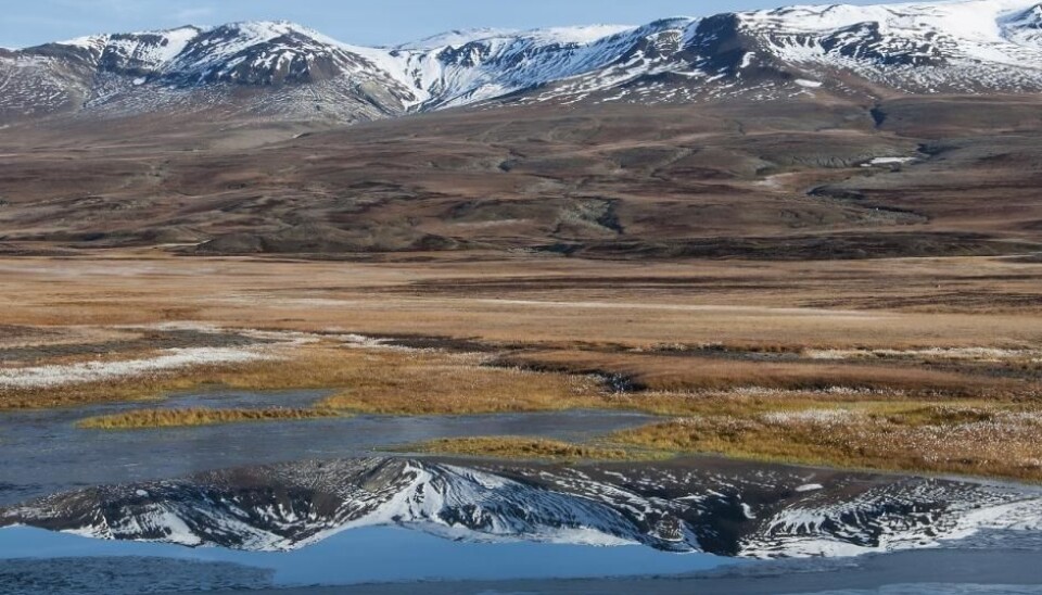
More precisely, they looked at surface temperatures (the temperature close to the Earth’s surface) in a part of the country that is not covered by ice—around one fifth of the surface area of Greenland.
Intuitively, you may think that temperature throughout all of Greenland has been increasing, but that is not the case. When you look at the yearly average, the ice-free parts of Greenland show a slight drop in temperature between 2001 and 2015. With swings in temperature from year to year.
However, these results should not be interpreted as “proof” that the Earth is not warming, say the scientists behind the research, which is published in the journal Scientific Reports.
This is weather, not climate

You need to have thirty years’ worth of data before you can “talk about climate,” says Professor Bo Elberling, an environmental geochemist and senior scientist on the study.
So we should be wary of discussing these results in the context of climate change, says Elberling, who is head of the Center for Permafrost (CENPERM) at the Department of Geosciences and Natural Resource Management at the University of Copenhagen, Denmark.
“What’s interesting here is that with these new data we have a unique description of the spatial distribution of surface temperatures across the entire ice-free part of Greenland, which we couldn’t pull out of the approximately 45 weather stations that cover Greenland today,” he says.
Read More: What makes the climate change?
Global warming is real
Professor Michael Tjernström, a meteorologist from Stockholm University, Sweden, agrees with this assessment.
The time series is too short to say anything about climate trends, he writes in an email to our sister site, Videnskab.dk.
“Give me a specific location and a short time series and you could get almost any trend. Over a large area and over longer time I'm sure Greenland is warming,” writes Tjernström, who was not involved in the study.
The results should be seen as a part of the natural swings in climate. While you might find a small drop in temperature at individual locations, the overall development is in one direction, he writes.
All scientists interviewed for this article agreed that the new study does not question the inescapable reality that the planet is getting warmer.
Read More: Human-induced global warming began 180 years ago
Satellite data help study trends in remote regions
The study is interesting for other reasons, says Professor Eigil Kaas, a professor in meteorology from the Niels Bohr Institute at the University of Copenhagen.
He points out that the methods used to calculate surface temperature throughout the ice-free parts of Greenland are entirely new.
“It’s an important study to be able to evaluate the actual temperature conditions in Greenland,” says Kaas, who was not involved in the research.
Today, temperature in Greenland is primarily measured with the help of 45 weather stations placed around the country and monitored by the Danish Meteorological Institute (DMI). They measure weather conditions frequently throughout the day at two meters above the surface.
The new method allows scientists to fill in the gaps between existing weather stations, says climate scientist Christian Rodehacke from DMI, who also was not part of the new study.
“This kind of observation system shows potential. For example, imagine that you want to measure the temperature at an uninhabited spot in Siberia. It’s very expensive to take measurements because the area is inaccessible, so satellite measurements are a big help. The same applies to large parts of Africa,” says Rodehacke.
Read More: Climate Change theme on ScienceNordic
The equivalent of hundreds of thousands of weather stations
The difference between the two types of data (satellite versus weather stations) is the level of spatial detail they provide, says Elberling.
Satellite derived data provide temperature right at the surface and therefore give a sense of the differences throughout the landscape, from the tops of hills to the bottom, on south or north facing mountain slopes, and in the upper part of fjords versus the lower part, closer to the sea.
The new study only presents data for the ice-free margins of Greenland, but the method can be used anywhere, such as the ice sheet.
The satellite data provides a detailed picture of temperature, down to just one square kilometre. That is the equivalent of hundreds of thousands of pixels, or the same number of individual weather stations across the ice-free areas of Greenland.
“Climate stations can give a very high temporal resolution for one location and for some stations over many years, which is relevant in a discussion about climate. Satellite data on the other hand provide a lower temporal resolution but an extremely detailed spatial picture,” says Elberling.
He adds that weather stations in Greenland are often located by towns, or along the coast, and are therefore not necessarily representative of all the ice-free areas.
“For example, one third of the country in the north is not included in such calculations,” he says.
Read More: “Treasure trove” of Arctic research data now publicly available
Understanding permafrost behaviour is crucial for country’s infrastructure
Elberling is a geographer and biologist, and not a climate scientist. So it was with great caution that he and his colleagues, who are not climatologists either, embarked on this study of temperature in Greenland.
Eighty per cent of Greenland is covered entirely by the Greenland ice sheet, whereas the ice-free areas are covered in permafrost—soil that has been completely frozen for two or more consecutive years.
Permafrost is found throughout the coastal regions of Greenland where most Greenlanders live. It goes without saying that permafrost requires low temperatures in order to stay frozen, and so it is crucial for roads, airports, and other infrastructure that permafrost remains stable and does not suddenly thaw, says Elberling.
“It’s important to quantify spatial trends in temperatures, even over a period of just 15 years, because infrastructure, farming, mine operations, and so on, are all effected by whether it becomes generally colder or warmer, or whether it varies from year to year,” says Elberling.
The new results may therefore be an important tool for infrastructure projects, says first-author Andreas Westergaard-Nielsen, from CENPERM.
“Our data could for example, be used as a guide, where you are considering multiple locations for a new airport, but can only afford one in-depth study of soil stability and permafrost at one spot. We can help to point you in the direction of where to investigate soil conditions further,” says Westergaard-Nielsen.
Read More: Arctic soils: a ticking climate time bomb
Greenland is a massive country
Permafrost is found in large areas of Greenland, Alaska, Canada, and Siberia, and is often referred to as the wild card of climate change.
Scientists do not know what will happen if permafrost partly thaws, releasing carbon dioxide (CO2), while plants grow more and in turn, take up more CO2.
“Everyone says that permafrost is thawing. Yes, but where? Our spatial analyses can provide a more detailed picture than the relatively few weather stations that are scattered around the country, and our method can be used across the whole Arctic,” says Elberling, adding that Greenland deserves a more detailed picture than it has had until now.
“It’s bothered me for many years that we always say that ‘Greenland’ is getting warmer. It’s a big country so we should of course be more nuanced—this is what we contribute to here,” he says.
Read More: Cold region ‘tipping point’ now inevitable in northern Europe
Still more work to do
Tjernström points out that the study does not yet present a specific application for the dataset.
“They aim to […] use this method of evaluating MODIS data for various studies, and they give several examples. But they don't do it here; just say they could,” writes Tjernström.
He writes that he may even have rejected the study if he had peer reviewed it, for this reason.
Although he also stresses that he was not able to view the supplementary information—additional information and data that are often submitted with scientific studies.
Applying the data will be the focus of future research, says Westergaard-Nielsen.
“The next step for us is to apply the study to assess a number of specific ecosystems, such as the response of plants to temperature changes and the sensitivity of permafrost,” he says.
Read More: Four big changes in the Arctic and what to do about them
Satellite data have many advantages
Michele Citterio from the Geological Survey of Denmark and Greenland (GEUS) is more positive. He was not involved in the research.
The study “succeeds in bringing attention to land surface temperatures as an important climate variable,” he writes in an email to Videnskab.dk.
Citterio points to the value of using satellite data and praises the scientists work to address some of the challenges that they present. For example, satellites observations are only possible when the sky is clear.
“When the sky is overcast the surface receives more infra-red radiation from the sky, resulting in comparatively warmer surface temperatures, but these warmer days can't be observed by the satellite precisely because of the cloud cover,” he writes.
“Without correcting for this cloud bias, the average surface temperature from satellites would be several degrees colder than actual in situ measurements. A particularly interesting contribution of this paper is the effort to correct for this limitation,” writes Citterio.
---------------
Read more in the Danish version of this article on Videnskab.dk
Translated by: Catherine Jex
Scientific links
- Contrasting temperature trends across the ice-free part of Greenland. doi:10.1038/s41598-018-19992-w