
Underground valleys discovered in Denmark
Denmark is riddled with underground valleys created during the last ice age, shows new research.
Denmark is well-known as a rather flat country. But even though it may not show much variation in topography, the underground is a very different story.
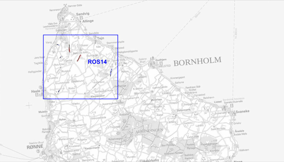
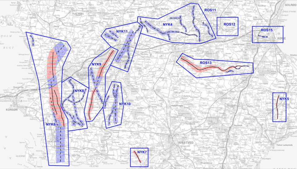
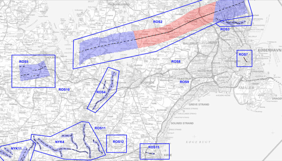
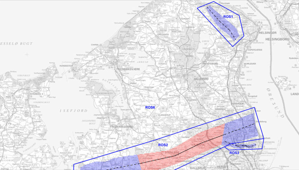
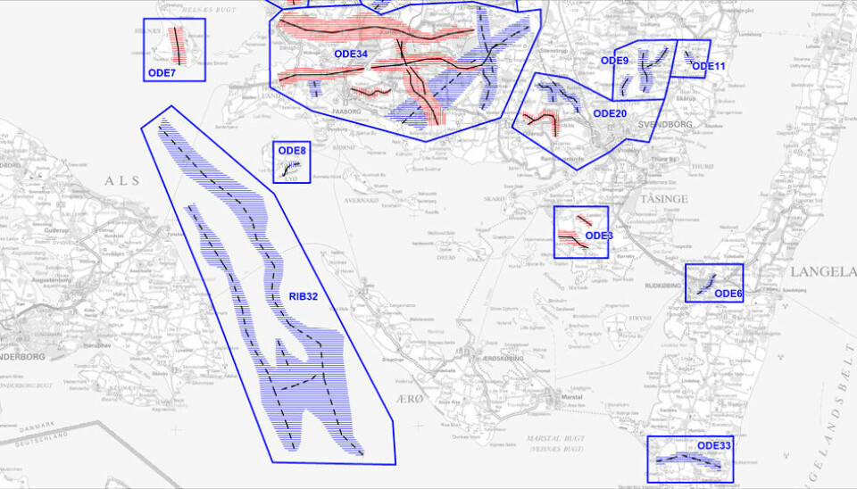
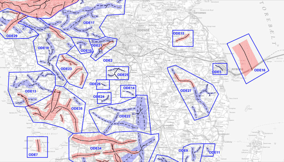
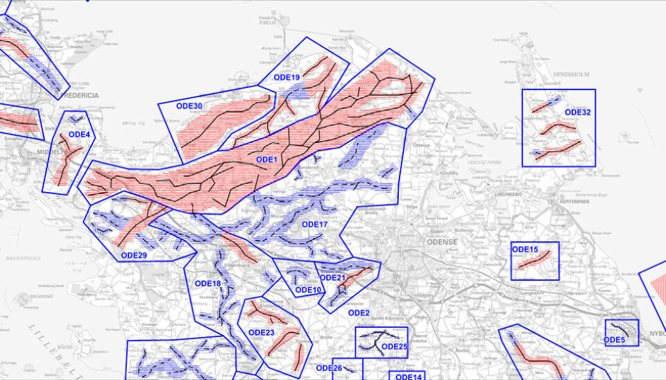
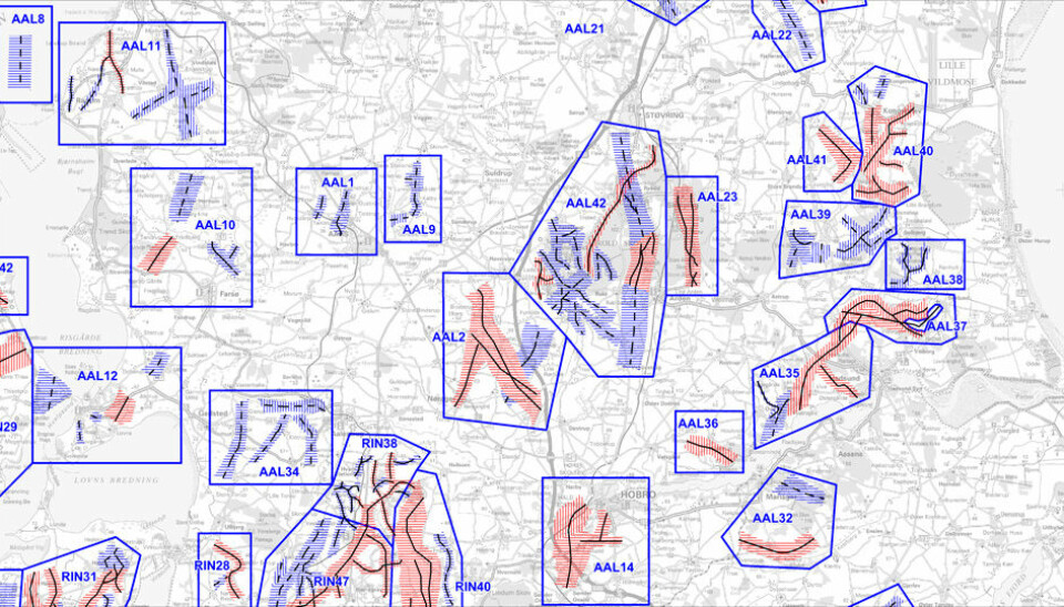
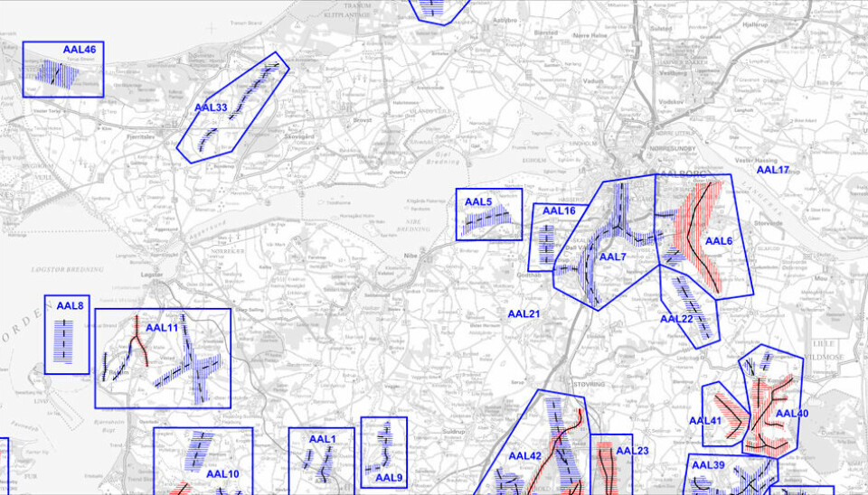
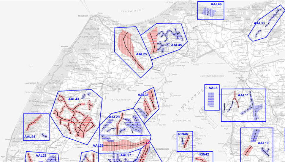
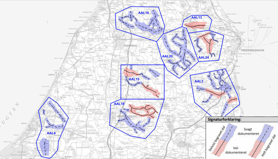
In two new reports, geologists have mapped numerous “underground valleys” that were created during the last ice age.
The scientists have mapped 40 per cent of the underground and found at least 5,600 kilometres of valleys.
“The discovery is spectacular. It’s really important for our understanding of the top 400 metres of the Danish underground,” says Senior Advisor Peter Sandersen, from the Geological Survey of Denmark and Greenland.
Read More: Remote corner of Greenland mapped in 3D
More effective groundwater extraction
The underground valleys are just like those found above ground--only filled with gravel, clay, and sand.
They are typically 25 to 300 metre deep and between 0.5 to 3.5 kilometres wide.
Scientists previously thought that the valleys formed before the last ice age, but the new maps show that they are subglacial features that formed beneath the ice sheet during the last ice age.
The vast majority formed by powerful currents in glacial meltwater underneath the thick ice sheet that covered Denmark during the last ice age.
Read More: Earthquakes may have formed Southern Denmark’s landscape
Improved access to clean drinking water
The geological layers inside underground valleys provide important access to drinking water. Some of them are deep enough to be untouched by surface pollution, whereas in some cases the valleys can funnel pollutants down into the deep groundwater deposits.
In both cases, geologists need to know the precise dimensions and locations of these valleys to extract groundwater effectively.
But these kinds of mapping projects also have other uses, says geologist Nicolaj Krog Larsen from the Department of Geoscience at Aarhus University, Denmark.
“It’s a massive undertaking to map these underground valleys,” says Larsen, who was not involved in the new project but has previously mapped the geology in this part of the world.
“The hydro-geophysical data included in mapping these underground valleys can be used in many ways,” says Larsen. “It can tell us something about how the geology fits together in Denmark, and how our hills and landscape formed. The study is really important for these reasons alone.”
Aarhus University have developed a new method to scan for groundwater and minerals. (Video: Aarhus University)
-----------------------
Read the Danish version of this story on Videnskab.dk
Translated by: Catherine Jex