New helicopter technology could save farmers millions
Danish scientists have developed a new method for measuring nitrate degradation in soil. The new method could save farmers a lot of money and help protect fish from oxygen depletion.
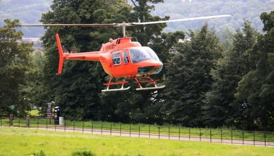
A new method makes it possible to look beneath the surface of the Earth while hovering above in a helicopter. The new technology can help identify where the environment is extra sensitive to manure and where it is unnecessary for farmers to limit emissions, because the soil is actually able to break down the nitrates in the manure.
This means that vulnerable places can be protected, while the farmers can safely use fertilisers in other areas.
“When we're able to find the places where the nitrates disappear on their own accord and those place where they don’t, we can target our efforts. There’s money to save here”, says Jens Christian Refsgaard, professor of hydrology at the Geological Survey of Denmark and Greenland (GEUS).
Together with scientists from NiCA (Nitrate Reduction in Geological Heterogeneous Catchment Areas), Refsgaard has recently presented the results of a four years' study on nitrates at a major conference in Aarhus, Denmark.
Lack of knowledge costs billions
Refsgaard says two thirds of the nitrates which leak into the soil from farmers' manure pose no danger, because they degrade naturally in the earth.
This means that much of the current attempts to limit nitrate release into lakes and streams by limiting the amount of manure spread on the fields, actually only contributes to removing a small amount of nitrates.
"Every time you remove three kg of nitrates, which might leak into the soil, the actual beneficial effect is equivalent to only one kg. That's poor efficiency," says Refsgaard.
Over the past couple of decades, Danish farmers have halved the amount of nitrate use. This has cost the farming industry millions of euros and continues to do so every year -- because the fertilisation is not optimal for growth.
Furthermore, over the next few years, Denmark will have to make further reductions in order to comply with EU regulations.
The Danish helicopter method
Precisely this combination of lack of efficiency and the new requirements to reduce nitrates were the point of departure for the study, which started four years ago with a grant of €1.9 from the The Danish Council for Strategic Research.
The scientists have tested their new method in the area around Norsminde Fjord near Odder in East Jutland, where there is a huge need to reduce the level of nitrate entering the fjord.
Here they used a helicopter which makes electromagnetic measurements to find out which areas are able to degrade nitrate and which lead the nitrates out into the fjord.
"A method already exists for charting the deeper layers of the soil from a helicopter, but it does not work very well to measure the uppermost layers, which play an important role in the degradation of nitrates,” says Refsgaard.
When the soil changes colour
The ability to measure the content of clay, through which water flows slowly, and sand, through which it flows quickly, as well as other materials in the uppermost layers of soil, enables scientist to assess where the water leaks downward and where it runs in the direction of a water body.
The crucial aspect is whether the water reaches the so-called redox boundary. “If you dig a hole in the ground you will find that at some stage the soil changes colour. It does so when the soil becomes anaerobic. When the nitrates reaches below this boundary they are removed of their own accord," explains Refsgaard.
Along with the methods for measuring the uppermost layers of the soil the researchers also presented calculation models for determining how deep the redox boundary is in the soil in a field, and how great the uncertainty is of the nitrates behaving differently in relation to the scientists' predictions.
Together, the measurements and the calculations can predict how much nitrate and manure the subsoil can withstand within a given area.
Nature Agency interested in the new method
At the Danish Nature Agency they are currently working on new rules which will ensure that Denmark lives up to the nitrate emission restrictions. They are very interested in the research project's method of measuring the soil very locally.
"We are interested in research that can further divide up the land on the geographic scale, but we are of course also aware of the uncertainties connected to this,” says Peter Kaarup, Head of Department at the Nature Agency.
"There can be huge differences in the soil layers, even within small areas. You don't gain much by mapping out a 15 km² chunk,” says Refsgaard.
Farming community is positive
At the Danish Agriculture & Food Council (Landbrug & Fødevarer) they agree with him. They, too, see the new research results as interesting.
"Reducing to much smaller scales is much more relevant, because then you can see the difference between the different types of soil. What the NiCa project will be able to show comes much closer to showing individual fields," says Flemming Gertz, who has participated in the study as a land consultant at the Knowledge Centre for Agriculture, which is owned by the Danish Agriculture & Food Council.
Among other things, Gertz has examined the financial consequences for farmers in not being able to spread enough manure.
”How much you can get out of your soil in comparison with other farmers in other countries means an awful lot to the individual farmer's bottom line profit," says Gertz.
-------------
Read the original story in Danish on Videnskab.dk
Translated by: Hugh Matthews
Scientific links
- NiCA-projekt: Om nitratreduktion i grundvand som virkemiddel
- NiCA grundlag for differentieret regulering af nitratudledning
- Landbrugsinfo: Hvad koster de underoptimale kvælstofnormer dansk landbrug?
