Earthquakes may have formed Southern Denmark’s landscape
The earth beneath Southern Denmark shook after the last age and created the landscape we see today, new research shows.
When the last ice age ended around 12,000 years ago, the kilometre-thick ice sheet that had previously covered Denmark during the ice age had retreated and the earth beneath began to move.
The ground had been pressed downwards and sidewards by the weight of the ice above it for thousands of years, but was suddenly able to reposition itself once it had melted away.
In a study published in the journal Boreas, scientists from the Geological Survey of Denmark and Greenland, GEUS, claim that tremors beneath the surface in Southern Denmark caused the ground to be pushed up in some places, and subside in others, creating the landscape we see today.
"We used to think that the depressions in the Southern Jutland landscape were created by huge blocks of ice left behind on what is now heathland when the ice retreated. But from new laser scans of the terrain we can see that the landscape actually follows the underlying tectonic structures,” says Peter Sandersen, a senior geologist from GEUS.
“This leads us to conclude that the landscape moved simultaneously with the deep tectonic structure, which likely caused a fairly powerful earthquake in the region," he says.
Colleague: An exciting study
Nicolaj Krogh Larsen is an assistant professor and geologist at the Department of Geosciences at Aarhus University in Denmark. Although not involved in the new study, he has read it and finds it extremely interesting.
"It's an exciting study which comes up with a plausible explanation as to why the landscape of this area of Southern Denmark looks the way it does. It is not the first time, either, that scientists have attempted to explain Denmark's landscape with a combination of reactivation of deep underground structures and ice age processes."
Heavy ice pushed down on the earth
More than 18,000 years ago, Denmark was covered in a kilometre-deep ice sheet, which stretched all the way down to the south of the country.
As the ice moved, much of the surface soil was scraped away in some places and deposited in others, forming hills like Mols Bjerge in East Jutland.
Mounds of material, consisting of rocks and gravel, were deposited in front of the ice -- so-called glacial till, carried by glacial meltwater. Eventually this material formed plains sloping away from the ice -- so-called outwash plains.
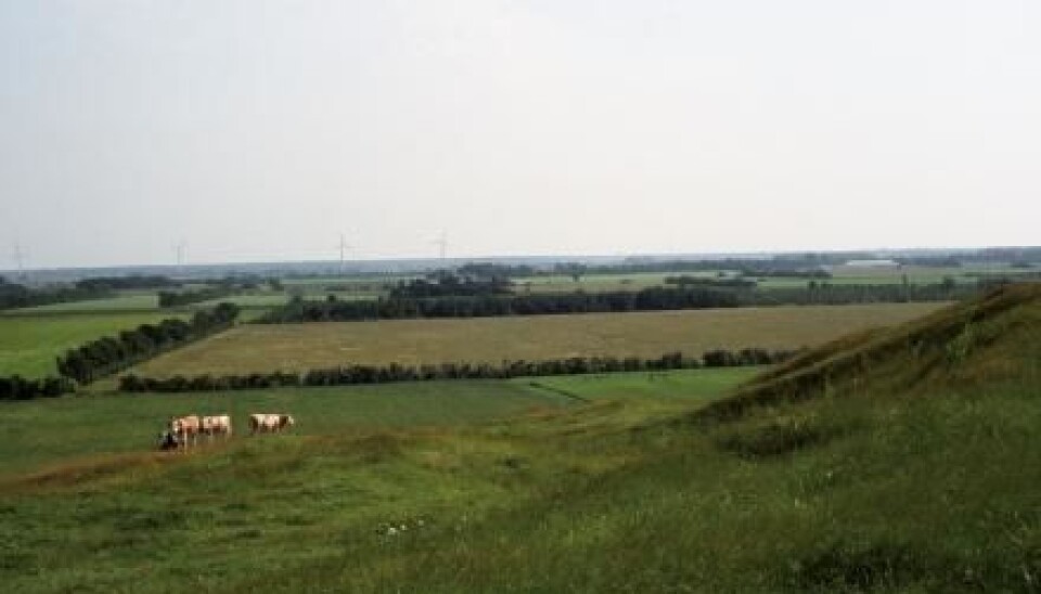
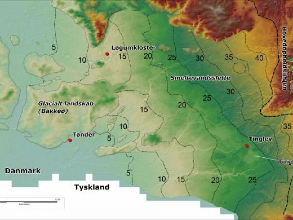
In Southern Jutland, where the new study took place, the landscape that was once underneath this ice sheet is today hilly, whereas the old outwash plain is now a large moorland.
Inexplicable features in the moorland plain
Hills and large depressions, now filled by lakes and bogs, litter the present day moorland.
Scientists thought these irregularities were the result of large blocks of ice, known as dead-ice blocks, left behind to melt after the ice had receded.
"The problem was, that these depressions and hills were too regular in shape to be explained as the result of dead-ice left on the outwash plain,” says Sandersen.
“Some of the depressions are more than a kilometre across, including Tinglev Moor, a lake which has since drained, and the landscape is also characterised by surfaces slanting in all directions -- none of this fits with what you would expect if it was due to melting of dead-ice," says Sandersen.
Depressions created by subterranean movement
When the glacier receded, so did the huge pressure that had been pressing down on the land, caused by the weight of the ice.
Huge amounts of energy were released as the pressure eased, causing the land surface to push up or subside.
"We can see that this happened quite quickly, because the streams on the outwash plain found their way around the obstacles, rather than cutting through them over time" says Sandersen.
No concrete link between the deep structures and the land surface features
According to Krogh Larsen the scientists in this new study are investigating structures hundreds of metres below the surface and comparing it with the uppermost layers of earth, 10-30 metres below the surface. And according to him, no definitive correlation has been found between these deep structures and surface layers.
"I don't feel that we have 'the smoking gun' that prooves that reactivation of deep subterranean structures played a significant role in the creation of Southern Jutland's topography,” he says.
“To prove this, more observations will be necessary, although this study is definitely a step in the right direction," says Krogh Larsen.
Laser-scanning the landscape
In the new study, the landscape features were mapped by LiDAR (light detection and ranging) radar, scanning the earth from an aeroplane.
The scientists have compared these data with scans of structures, deep under the earth, and could see the two matched.
"This is a new technology which can help us come up with some ideas as to how Denmark's hills and depressions formed," says Sandersen.
Groundwater is more vulnerable than previously thought
Sandersen also believes that the new results can be useful for groundwater vulnerability assessments.
The new result shows that subterranean structures can lead right up to the surface. This means that fluids, including pollutants, may be able to seep deep down along these fault lines.
"Our research shows that in some places the substratum has fragmented, which means that in these places the groundwater is not as well protected from seepage from the surface as one might think," says Sandersen.
--------------
Read the Danish version of this article on Videnskab.dk
Translated by: Hugh Matthews