Researchers' Zone:
Satellite data can help us studying Earth’s water cycle and understand droughts
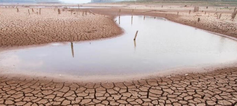
Microwave satellite systems can see through clouds and provide valuable insights to the drought prone Senegalese Sahel.
We may not feel it directly here in the North of Europe, but droughts and lack of water are global issues that are likely to become more severe as average global temperature rises.
However, our knowledge of droughts on regional to global scales is still limited. What steps can we take to improve this?
At the Department of Hydrology at the Geological Survey of Denmark and Greenland (GEUS) we investigate ways to further our understanding of the terrestrial water cycle and to develop methods to better observe and model key components of the water cycle.
The ALL-WET project, short for all-weather evapotranspiration project, brings together scientists from GEUS, the University of Copenhagen and international collaborators from NASA and the U.S Department of Agriculture.
Our mission is finding new ways of utilizing satellite data to study the water cycle of the Senegalese Sahel, a region suffering from intense droughts with severe effects for both ecosystems and livelihoods.
Our current methods are limited
At the center of our research is evapotranspiration (ET), which relates to the amount of water being transferred from the land surface to the atmosphere through plant transpiration and evaporation.
The hydrological cycle covers all relevant hydrological components and processes on land. Among them precipitation constitutes the prime inflow of water to the system. ET and river flow capture the the main outflows.
Globally, ET accounts for approximately 2/3 of the incoming precipitation over land. Further, ET is controlled by the availability of water and energy, soil properties and vegetation dynamics at the land surface.
Observing and modelling ET is quite challenging and most often, especially for large scale applications, satellite data is the only viable source.
However, ET cannot be measured directly and therefore numerous indirect modelling approaches have been developed.
Among these approaches, ET can be derived from satellite data on land-surface temperature as obtained from spectral information in thermal cameras that capture the thermal infrared spectrum.
This approach is well established but limited to cloud free conditions. Therefore, it does not reflect the full complexity of the spatial and temporal variability of ET.
And this is where the need for new microwave satellite systems comes in.
Microwaves to save the day
Under typical tropical or subtropical conditions, thermal infrared systems will fail at providing sufficient land surface temperature observations during the rainy season to reliably derive ET.
This limitation can be overcome by making use of microwave retrievals of land-surface temperature that are not constrained by cloud cover.
In comparison to traditional thermal infrared-based observations, microwaves have longer wavelengths (0.1–1 m). This makes microwave observations of the land surface generally less susceptible to cloud effects than thermal infrared observations.
Therefore, we can use microwave observations to obtain an all-weather representation of ET.
With this possibility of microwave satellite systems our hypothesis is that such data can contribute significantly to understanding the water balance for Earth’s tropical and subtropical regions that are typically very cloudy.
Models for measuring climate effects
ET is an extremely valuable variable to evaluate hydrological models against. Such models are computer-based representations of the terrestrial water cycle and can vary in complexity depending on the range of hydrological processes they contain.
We apply hydrological models because we cannot measure everything everywhere and therefore these models can integrate all available observations, such as river flow, soil moisture, groundwater or ET.
These models make us able to quantify effects of climate change on the hydrological cycle as well as test the impact of water management scenarios, for instance changes in groundwater pumping or agricultural practices, on the water resources.
We expect that microwave-based ET data can contribute to more reliable hydrological models, because the models are confronted with an all-weather representation of ET instead of clear-sky snapshots provided by thermal infrared data.
Confronting models with a wide range of observations and tuning their parameters to match these observations optimally is necessary, and the more diverse and representative the observational dataset is, the more robust and useful hydrological models will be.
Saving the trees in Sahel
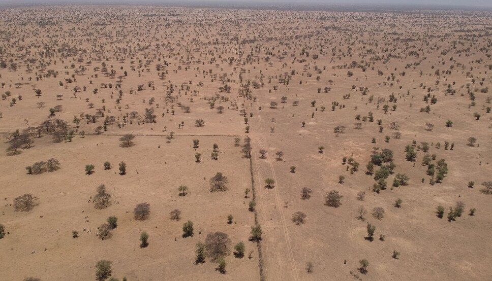
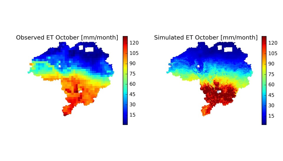
In order to test our hypothesis, we need a specific case. We therefore test the usability of microwave-based ET data to build a reliable hydrological model on the Senegal River basin (~75000km2) in the Sahel belt in West Africa.
The Senegal River basin is highly affected by cloud cover with limited possibilities of thermal infrared data and this makes it a perfect test case.
Roughly, satellite based thermal infrared data is present for 20% of days of a year, whereas microwave based observations can reach a coverage of up to 80%.
The purpose of the hydrological model is to understand the vegetation developments and their impact on the water cycle of the Senegalese Sahel.
This region has undergone major environmental changes in the past 50 years because of a considerable drop in annual rainfall and increasing human activities impacting its ecosystems.
In particular, significant tree die-off has been observed in the years 2014 and 2015 in response to drought. The massive die-off affected a specific species of trees that is known to have low drought resilience.
With the ALL-WET project, we expect to foster understanding of the cause of this die-off event by providing additional hydrological insights. Furthermore we will showcase how to optimally use microwave data in hydrological investigations.
The ALL-WET project is funded by Geocenter Danmark.
———