New weather forecast system makes predictions faster and more accurate
Denmark launches a world-first weather forecast system that can provide more accurate forecasts by the hour, using just a fraction of the computing power of conventional models.
Weather forecasting agencies around the world are constantly developing new systems to produce ever more accurate forecasts, capable of capturing fast moving, often chaotic and localised weather events. But this means bigger models and even bigger computing capacity.
But scientists at the Danish Meteorological Institute (DMI) may have found a work around. Their new forecasting setup should provide more precise weather forecasts, updated every hour, while using a fraction of the computing power typically required by such systems.
“No one in the world is doing this,” says DMI scientist Xiaohua Yang, who designed the new system, which is called the Continuous Mesoscale Ensemble Prediction System—or COMEPS.
The new system has been running alongside DMI’s regular forecasts for Denmark and the Faeroe Islands, since September 2016. During this time it has convincingly outperformed the existing system, producing an hourly updated forecast and predicting weather conditions at a much finer scale than previously, says Yang.

“So far it has performed consistently better than the existing systems,” he says.
DMI officially switched over to COMEPS at midnight last night, and will now use this setup for their daily operational forecasts.
Read More: Long term funding cuts put the squeeze on DMI
Better resolution to improve predictions of extreme events
According to Yang, the new setup offers several advantages over traditional forecasting systems. One is that more frequent updates should make their short-term forecasts more accurate.
“The weather forecast used to be refreshed every six hours, then with the previous upgrade [in June 2016] it was every three hours. With the new COMEP system we’ll be able to do it every hour,” he says.
The hourly updates use the latest observations from satellite data and data from across DMI’s observational network of weather stations and radars and should avoid sudden changes from one forecast to the next after each update.
Another improvement is that the new system can forecast conditions for every 2.5 square kilometres, which should help them to capture localised events. The previous system produced meteorological data for every 5.5 square kilometres. Yang and his colleagues at DMI are now experimenting with even smaller scales, down to as little as 300 metres.
This, he says, in combination with more frequent updates, will provide an almost continuous local forecast that will allow DMI to improve their predictions of chaotic and often highly localised extreme weather events more precisely, such as cloud bursts—severe storms that can develop quickly with little advance warning.
Read More: Understanding tiny droplets can make for better weather forecasts
Global interest in new system
Other countries are watching to see how much of an improvement the new setup offers.
Inger-Lise Frogner from the Department of Research and Development at the Norwegian Meteorological Institute describes this type of approach as “state of the art and in line with what other institutes are running and developing.”
"These types of setups are the best that we can do with our current knowledge and computing power,” she says.
The national meteorological agencies in the Nordics plan to establish a joint forecasting consortium in 2022. The plan is to have one common forecasting system in operation by then.
“We don’t yet know what ensemble system we will use, but this is an interesting option,” says Frogner.
Yang says several countries outside of the Nordics have also expressed interest in the new system.
“We hope that with the operational launch we’ll make a strong case,” he says.
Read More: Greenland melt linked to weird weather in Europe and USA
Swedish colleague: curbed enthusiasm
Ulf Andrae is head of development for the operational meteorological model within MetCoOp, a cooperation between the Norwegian Meteorological Institute, the Swedish Meteorological and Hydrological Institute (SMHI), and the Finnish Meteorological Institute (FMI), and an expert in numerical modelling and high performance computing at SMHI. He is weary of singing the praises of DMI’s new system until he has seen the results.
“All institutes are heading in this direction, towards something called ‘“nowcasting,’” which means that you update the forecast every hour with input from meteorological observations,” he says.
Andrae says that DMI and MetCoOp will send data to each other and compare forecasts between their two systems. In a couple of weeks they should know if there are any major differences, he says.
“What DMI is doing is interesting but we have to wait to see what the pros and cons are,” says Andrae.
Read More: What do you do when extreme weather destroys your home?
Uses existing model with a new layer of statistics
The new setup is comprised of two existing models, which are run multiple times to produce a so-called ensemble forecast--essentially lots of slightly different individual weather forecasts that can all be analysed all at once.
This produces an ensemble of possible weather scenarios for a certain location at a certain time in the future, which the forecasters then use to calculate the probability of heavy rain or bright sunshine, for example.
Running more ensembles at regular intervals allows forecasters to see a greater spread of results that are updated as often as possible with up to date observations from weather stations, satellites, and radar networks.
“It’s not a new concept, but DMI is utilising the computer resources they have available in a clever way,” says Frogner.
Read More: Studying shooting stars to improve weather forecasting
“It’s magic in terms of computing power”
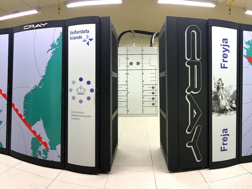
Increasing the amount of model runs requires an extraordinary amount of computing power, which can only be accomplished with expensive super computers.
Yang’s priority was to run a bigger model without increasing the amount of computing power beyond DMI’s current capacity. “Every time you double the resolution of your model you need around ten times more computing capability,” he says.
The secret is in the timing.
DMI’s new system splits up their simulations so that just a handful are launched every hour. This reduces the overall computing power needed at any one time and spreads the demand for energy more evenly throughout the day.
See a description of how the system works in the side story below.
“It’s magic in terms of computational power,” says Yang.
Frogner agrees.
“This approach is a way of better utilising the available computing power. Some institutes may use a similar approach, but they’re not using it in the same way, every hour,” she says.


