New model can help predict flooding two days in advance
A new model can monitor underground water in real-time and will help to improve early flood warnings.
When it comes to predicting when and where the next devastating flood will strike, meteorologists and town planners need more information than simply the weather forecast for that week.
They also need to know what is happening underground. How high is the water table? And how wet is the soil? But many flood-forecasting models do not include this information.
Now, a group of Danish scientists have developed a nationwide model that could help local flood forecasters predict imminent floods up to 48 hours ahead of time.
“In the future we will need systems like this, as the world is warmer and wetter, and rivers are fuller,” says co-author Hans Jørgen Henriksen, a hydrologist from the Geological Survey of Denmark and Greenland (GEUS).
The new model was recently presented at the annual meeting of the American Geophysical Union, in San Francisco, USA--the largest natural sciences conference in the world, where around 25,000 scientists gather each year to discuss their latest research.
Hourly reading of the water cycle
The new model uses weather forecast data for the whole of Denmark to predict how much water exists underground--in the water table, in the soil, and in rivers.
It is currently running in test mode, where the scientists are feeding the model with weather data from the past to see how well it predicts potential flood hazards around the country.
Once implemented, it will run in real-time and be updated with actual weather forecast data every hour. It will make predictions of the state of the hydrological system throughout the country 48-hours in advance.
This data can then be used by local flood forecasters to improve their own models.
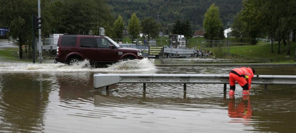
Flooding can occur with very little rain
One particular advantage of the new model is that it will help flood forecasters to pick up on events that could be missed when scientists don’t have any data on the amount of water held underground.
“After a long period of moderate rain, the system [soil and water table] is filled to the water-holding capacity, and just a small rain event, maybe 20 millimetres of rain, can lead to a flood,” says co-author Simon Stisen, also from GEUS.
“But under different hydrological conditions, where there's not as much water already in the system, this same rain event might not have any effect at all, and so this is the real strength of the model,” he says.
The need for such a system in Denmark was made crystal clear when in early December 2015, a flash flood caught one local community off guard, says Henriksen.
“They’d had a lot of precipitation leading up to the event,” he says.
“I’m quite sure that if they’d had our model running, with better real time knowledge about the abnormal wet situation of the water cycle in the catchment, including soil moisture, groundwater levels, and [rainfall], then they’d have been better prepared,” he says.
But the model is not only of use in Denmark. Both Stisen and Henriksen suggest that a similar system would be useful in other regions where ground water plays an important role in regulating flood risks, such as central Europe. It may also be useful for long-term planning of irrigation supplies in countries like Spain or Australia, they say.
Colleague: impressive work
Dr Hoori Ajami, a hydrologist at the University of New South Wales in Sydney, Australia, was not involved in the new research, but she was at the conference and saw lead-author Xin He from GEUS present the results.
According to her, the model is an interesting development on similar work that is currently being developed in Australia.
“They are using a fully distributed hydrologic model, which includes major hydrologic processes. In that respect, the system is great. However, I think they are still at the early stage of development before they have a fully working flood warning system,” says Ajami.
According to Stisen and Henriksen, the model could be ready to roll out in 4 to 5 years’ time, which will also coincide with a new weather forecasting model from the Danish Meteorological Institute (DMI), who will provide the vital weather data to run the model.
But, they need funding first.
“We hope we can get some funding and get it running as a combined weather-groundwater forecast, in close collaboration with DMI. This is the vision, but we need the funding to do it,” says Henriksen
“We’re working on that right now,” he says.
Scientific links
- Real-time hydrological early warning system at national scale for surface water and groundwater with stakeholder involvement
- Geological Survey of Denmark and Greenland Bulletin 33, 2015. A hydrological early warning system for Denmark based on the national model