Greenland Ice Sheet has already caused nearly five metres sea-level rise
New calculations show the true extent of ice melt from the Greenland ice sheet over the past 23,000 years.
Melting Greenland ice has caused 4.6 metres of sea level rise in the last 23,000 years, shows a new study.
Scientists have calculated the size of the Greenland ice sheet at the end of the last ice age, and which areas of the ice sheet have since disappeared.
According to the scientists behind the new research, the results can be used by climate scientists to calculate how much sea level rise will occur in the future and ultimately find out which coastal areas may soon be inundated by the sea.
“We have satellite measurements and aerial photos that show us how much of the Greenland ice sheet has retreated over the last 20 to 100 years, but to get a complete picture of the ice sheet’s influence on future sea levels, we need to go further back in time and look at present day sea melting in relation to the past,” says lead author Shfaqat Abbas Khan from the Technical University of Denmark (DTU).
“We can do this with these results that show where the greatest ice melt has occurred over time,” says Khan.
The new results are published in the scientific journal Science Advances.
Enough water for 7.5 metres of sea level rise remains
The Greenland ice sheet is currently the biggest contributor to global sea level rise, which is expected to increase by more than one metre by the end of the century, according to predictions in the latest IPCC report.
In total, the Greenland ice sheet holds enough frozen water to increase global sea levels by another 7.5 metres above the current level, and it is therefore important that climate models include these new data.
“We want to know whether the ice melt that we have today is unique and what we can expect in the future. Will ice melt at the same rate as earlier or will it be higher? And will it melt from the same areas in Greenland?” says Khan.
Greenland itself is rising out of the sea
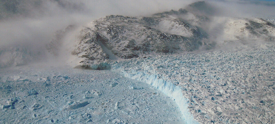
In the new study, scientists from DTU have collected data from GPS stations that measure the rise of Greenland itself.
This gigantic island has been rising up out of the sea throughout the last 23,000 years as the ice cap melts and the huge weight of ice that presses down on the land eases.
By calculating the rate at which the land has risen, Khan and his colleagues can estimate the amount of ice that has historically held Greenland down.
During the last ice age, 23,000 years ago, there was probably enough ice on Greenland to increase global sea level rise by around 12 metres.
“The computer model results show us how large the ice sheet was at the end of the last ice age, before the ice started to melt. We can then calculate how much has melted since then by comparing it to the size of the ice sheet today,” says Khan.
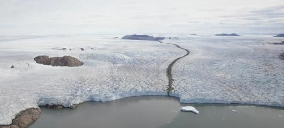
These two areas melt the most
The regional measurements show that historically, southeast Greenland and northwest Greenland have lost the most ice. Up to 40 per cent of all ice loss came from these two areas--much more than scientists had previously estimated.
And these high rates of ice loss continue today, as these same two areas are still especially active.
“It’s interesting that we now can show for the first time that it’s not only today that northwest Greenland and southeast account for the greatest ice loss,” says Khan.
“It’s been this way for 23,000 years, where these areas have really lost a lot of their total mass, and we have to assume that it’s not going to stop just yet. In this way our results can be used in models that predict sea level rise to say that melt will probably continue in these areas,” says Khan.
These areas are particularly vulnerable as they are in contact with the sea.
“It means that smaller changes in temperature appear to have a bigger effect here. Future temperature changes, whether they are natural or man-made, can also be expected to have a major impact in these areas,” he says.
Climate models will be adjusted
Senior scientist Andreas Peter Ahlstrøm from the Geological Survey for Denmark and Greenland (GEUS) describes the results as “incredibly exciting.” He did not take part in the new research.
“It shows that satellite measurement alone are not enough to estimate loss of ice sheet mass. It’s essential to have direct observations, otherwise we will underestimate the contribution of Greenland ice melt to global sea level rise,” says Ahlstrøm
He is also excited about the regional measurements.
“Another important result is that the heat from the bedrock is greater in east Greenland than we had previously thought,” says Ahlstrøm.
“This presumably means that the ice is also warmer and flows more easily in these important areas, and so may be more sensitive to climate change. Our computer models of the ice sheet’s response to climate change needs to be adjusted,” he says.
Greenland is getting bigger
In the future, Greenland will actually grow as it continues to lose ice and the land rises out of the sea.
While many countries can expect to lose land to rising seas, Greenland will actually gain landmass.
“It’s positive news for Greenlanders, though not so good for many other countries,” says Khan.
The animation shows how Greenland rises up and out of the sea as the ice sheet melts. Bedrock has rebounded most in northwest Greenland and south Greenland, where ice has melted the most. (Video: the University of Buffalo, USA)
-------------
Read the Danish version of this article on Videnskab.dk
Translated by: Catherine Jex