3D technology allows scientists to model Greenland's past
VIDEO: See how the scientists used 3D technology to discover new details about Greenland’s past.
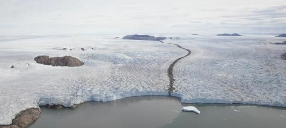
Scientists from the Geological Survey of Denmark and Greenland (GEUS) are keeping busy on Greenland these days. They are currently attempting to map Northeastern Greenland with an advanced 3D technology that makes it possible to see how the landscape has changed over time.
Using aerial photography, Ph.D. student Kristian Svennevig stacks overlapping photos of the Greenlandic landscape and loads them into his computer. He then creates a 3D-model of them which allows him to see what the landscape used to look like.
The method of using overlapping aerial photography has been around since the 1980s but it is only with the advent of modern 3D technology that it has been possible to use it to look into the past.
You can watch Svennevig explain his work in a new video from GEUS’s new website: undergroundchannel.dk.
3D technology leads to better 2D maps
Svennevig is currently working on mapping Northern Greenland in much greater detail than previously possible.
”Now that we have these high quality 3D images--and my models--it’s a rather simple step to provide the cartographers with these data and have them draw an old school map on paper,” says Svennevig in the video.
It is the first time in eight years that GEUS creates an old-fashioned paper map.
----------------
Read the original story in Danish on Videnskab.dk
Translated by: Kristian Secher